Schuylkill Navigation Maps
at
Reading Area Community College

|
Schuylkill Navigation Maps at Reading Area Community College |
||
|
|
|
The Sixth Reach Vincent Canal from Lock 60 to Lock 57 To view an image, click on the thumbnail. Use your browser's back button to return. Please note the file sizes. |
|||||
|
Large Maps
|
Map #
|
Description |
File Sizes
|
||
| 6-6 | Vincent's Canal between Pennypacker's culverts | 119k | |||
| 6-101 | Lock 58 and guard lock | 153k | |||
| 6-102 | Vincent Canal | 82k | |||
| 6-104 | Feeder at Vincent Dam | 149k | |||
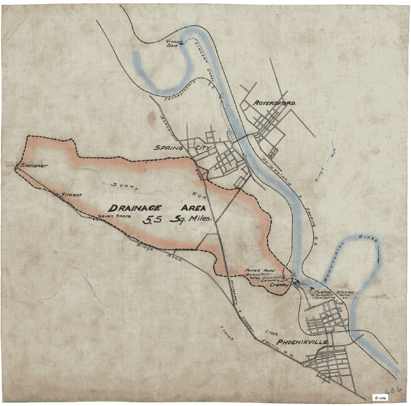 |
6-106 | Drainage basin of Stoney Run | 151k | ||
| 6-108 | Additional feeder openings at Spring City stop gate | 142k | |||
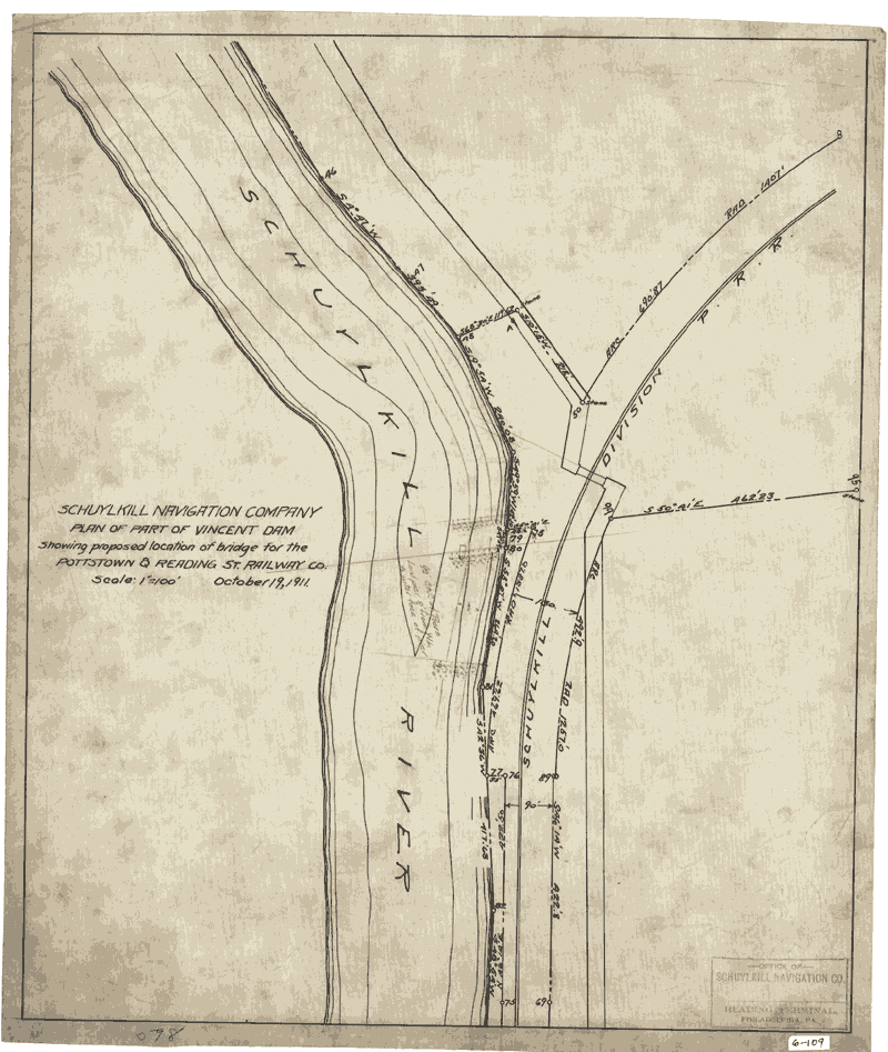 |
6-109 | Part of Vincent Dam | 121k | ||
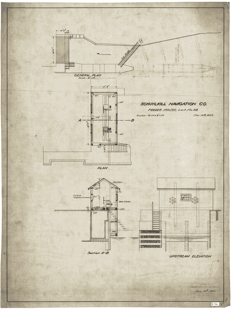 |
6-116 | Feeder house, Lock 58 | 150k | ||
| 6-117 | Feeder for water power, Lock 58 | 110k | |||
| Small Maps | Map # | Description | File Sizes | ||
| 6-S7 | Proposed new wharf in Spring City | 99k | |||
| 6-S12 | Property survey along Vincent Canal | 124k | |||
| 6-S102 | Drainage basin of Stoney Run | 77k | |||
| 6-S103 | Wismer Aqueduct above Lock 59 | 157k | |||
| 6-S104 | Vincent Dam (reverse image) | 102k | |||
| 6-S108 | Footpath along canal at Cromby | 112k | |||
| 6-S110 | Property adjoining Vincenmt Canal above Spring City | 128k | |||
| 6-S116 | Lockhouse and Lock 59 | 55k | |||
| 6-S118 | Intake tunnel to power house on Vincent Canal | 37k | |||
| 6-S124 | Properties along Vincent Canal | 96k | |||
|
Creation of this web site funded by a grant from the Commonwealth of Pennsylvania Library Services and Technology Act
|
||
|
Copyright © 2011 Reading Area Community College |
||